Arrowhead Lake, NJ Elevation & Topographic Map
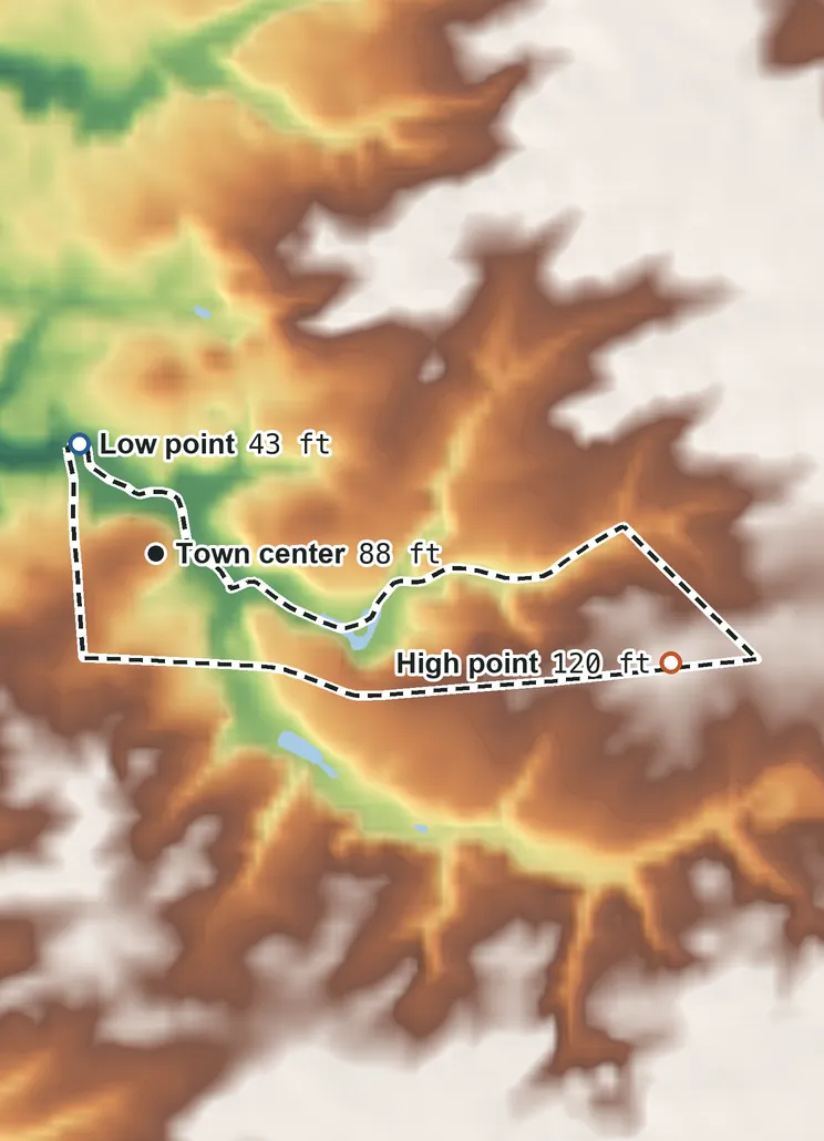
Elevation
120 ft 35 m100 ft 30 m90 ft 28 m71 ft 22 m52 ft 16 m43 ft 13 m
Contours every 40 ft, bold every 200 ft
USGS 3DEP · U.S. Census Bureau
How to use this mapviews, tools and data
- Elevation
- Ground colored by height from green (lowest) to white (highest), with contour lines every 40–500 ft (USGS data).
- Satellite
- A 2016 satellite photo at 33 ft (10 m) detail; contours off.
- 3D
- Tilt and turn the terrain; hills are raised 1.5×, or set ×1 for true height.
- Click or tap anywhere
- The exact elevation of that spot in ft and m.
- Measure
- Pick two points for the climb, descent and grade along a straight line.
- Area
- Fades everything outside the official CDP boundary (US Census).
Elevation Data
Arrowhead Lake sits at about 85 ft (26 m) above sea level, the median height of all land inside the CDP boundary (too few residents to weight by).
Typical elevation (all land)
85 ft 26 m
few residents
Lowest
43 ft 13 m
on the northwest side
Highest
120 ft 35 m
on the east side
Average
85 ft 26 m
all land inside the CDP boundary
Arrowhead Lake spans about 77 ft of height, so no single spot tells the whole story. The ruler shows where its people live, and where the other numbers you'll see come from.
| Figure | Elevation |
|---|---|
| Typical (all land) Median of all land; too few residents to weight by | 85 ft26 m |
| Highest point Inside the CDP boundary, on the east side | 120 ft35 m |
| Lowest point Inside the CDP boundary, on the northwest side | 43 ft13 m |
| Town center USGS map point for Arrowhead Lake | 88 ft27 m |
| Average of all land | 85 ft26 m |
Elevation profile, west to east
1.0 mi west to east through the town center.
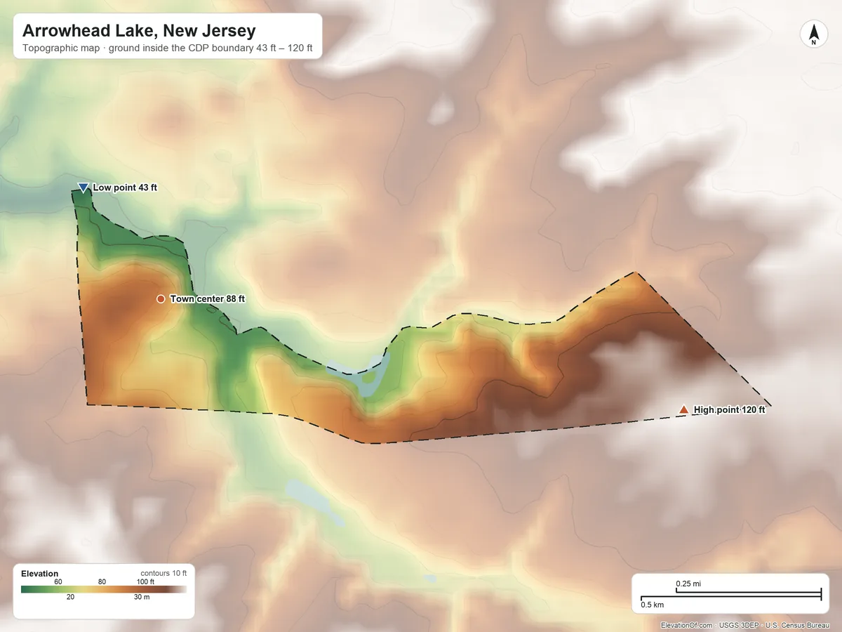
Topographic Map
- Location
- Unincorporated community (census-designated place) in Cumberland County, New Jersey, United States
- Population
- 126 2020 Census
- Land area
- 0.2 sq mi
- Density
- 568 per sq mi
- Coordinates
- 39.4771° N, 75.3246° W
- Time zone
- Eastern UTC−5 / −4
- Landform region
- Coastal Plain
- Drains to
- Atlantic Ocean
- ZIP codes 1
- 08302
⤓ Download this map
WebP, 1200 × 900. Free to use: credit “ElevationOf.com” with a link to this page.
Sources: U.S. Census Bureau, USGS
Nearby Places
Nearby towns by typical elevation
- Shiloh110 ft
- Roadstown110 ft
- Arrowhead Lake85 ft
- Stow Creek Township85 ft
- West Park83 ft
- Hopewell Township, Cumberland County81 ft
- Marlboro76 ft
- Silver Lake, Cumberland County74 ft
- Lakeside-Beebe Run70 ft
- Seeley68 ft
- Othello29 ft
Rankings by typical elevation
- Towns in New Jersey487th highest of 941
- Towns in Cumberland County10th highest of 49
Peaks and hills nearest, by height
- Coffin Hill120 ft
- Big Mannington Hill120 ft
- Pine Mount93 ft
How we measure
- Typical elevation: the median height of all land inside the CDP boundary; too few residents live here to weight by people.
- Lowest, highest, average: USGS 3DEP bare-earth heights on a 1 arc-second (≈100 ft, 30 m) grid, land only, inside the Census CDP boundary (TIGER, Jan 1 2026).
- Nearby Places: nearby towns and rankings use each town's typical elevation, so every town is compared like for like. Rankings count every city, town, township and census-designated place, including places inside a town. Peaks and hills: the nearest summits with at least 980 ft (300 m) of prominence within 62 mi (100 km), then federal (GNIS) summits within 16 mi (25 km) when there are fewer than 5; each is the 3DEP top on a ~7 ft (2 m) window, or the NGS published height when a usable survey mark sits within 160 ft (50 m) of it (shown as published).
- Rounding: computed heights are rounded to 10 ft (5 m), or to 1 ft (1 m) under 100 ft; 3DEP is good to about a meter, not a foot. Published figures (FAA airport elevation, NGS survey heights) are shown as their publisher gives them.
- Datum: North American Vertical Datum of 1988 (NAVD 88). NGS plans to replace NAVD 88 with a new datum (NAPGD2022); heights will then shift slightly.
- Arrowhead Lake is an unincorporated community; figures cover the census-designated place, a statistical area.
- Sources: USGS 3DEP, GNIS, Watershed Boundary Dataset and physiographic provinces; U.S. Census Bureau (boundaries, 2020 blocks, Gazetteer areas, ZIP code areas); BTS time zones. All public domain.